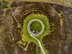
The original stone mound, measuring 12.4 metres from north to south and 13.8 metres from east to west, has been partially repurposed for a trigonometrical station; one of those distinctive concrete pillars used by the Ordnance Survey for mapping Ireland. Despite this modern intervention, the cairn's perimeter can still be traced, offering visitors a tangible connection to the prehistoric landscape.
Just to the south-southeast of the cairn lies a particularly intriguing stone, roughly one metre by 75 centimetres in size. Carved into its surface is a small plain cross, measuring just 12 by 13 centimetres, suggesting the site held spiritual significance long after its original builders had vanished into prehistory. The stone also bears more recent graffiti, showing how this remote spot has continued to draw visitors across the centuries.
The location itself is dramatic, with Greenan mountain dominating the eastern horizon. These cairns, found throughout Ireland's uplands, likely served multiple purposes; as burial monuments, territorial markers, or clearance cairns created as ancient farmers cleared stones from their fields. The later addition of the Christian cross and the Victorian era trigonometrical station demonstrates how significant landmarks in the landscape are repeatedly claimed and reclaimed by successive generations, each leaving their own mark on this windswept ridge.