The site left no monuments, no ruins, no interpretive signage. Its existence was preserved almost entirely in a field name: the "Chappie Field", as it appeared on a map of the Estate of James Marinus Kennedy in 1761, and "Chapel Hill" on a later map of the area dating to no later than 1785. As recently as 1944, the local writer Liam Ua Broin noted that the field was still known as the Chapel Field, and that a mound with a little outcropping masonry was traditionally regarded as marking a church site, though he allowed that it might equally be the remains of a rath, a type of circular earthen enclosure used as a farmstead in early medieval Ireland.
When Dublin County Council began survey work in 1962 ahead of a proposed housing scheme, they identified an earthen banked enclosure whose exact nature was unclear. The following January, rescue excavations led by Etienne Rynne of the National Museum of Ireland revealed the foundations of a stone nave and chancel church set within a roughly oval ecclesiastical enclosure measuring approximately 48 metres east to west and 40 metres north to south. The church walls were 0.9 metres thick, and a two-level altar, unmortared and without foundations, survived at the east end of the chancel. Rynne suggested its lower portion may have served as a platform for the celebrant, with the upper section as the altar base, possibly once topped by a wooden structure. What made the excavation particularly striking was the human bone, found in large quantities and in considerable disorder, concentrated within and around the church but scattered across the enclosure as well. Bones, mostly of children, were found within the wall foundations themselves and among the stones of the altar. Rynne concluded that the site had been used extensively for burial before the stone church was ever built, and he suggested that a wooden church may have occupied the enclosure as early as the eleventh century, when a bronze ring-pin was lost on the site. The stone church was likely built in early medieval times and had been destroyed before the end of the eighteenth century.
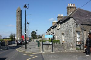
There is nothing to see at the site today. The housing estate has entirely absorbed it, and no surface trace of the excavated church remains visible. The value in knowing about it lies less in any physical visit than in the accumulation of small historical details: a field name holding a memory across three centuries, a community that kept calling it the Chapel Field long after the building was gone, and bones in the foundations of an altar that speak to an even older use of the ground. Rynne's excavation report was published in 1967, and the site coordinates place it clearly south-east of Watery Lane in Clondalkin, for anyone wishing to look at the ordinary streetscape with that knowledge in mind.