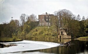
A small stream running southward through wet Kildare pasture divides what was once a carefully organised medieval landscape into two distinct halves, each preserving the faint but readable traces of how people worked, defended, and worshipped in this corner of the Liffey valley. The whole complex stretches roughly 450 metres east to west and 280 metres north to south, and while little of it rises more than a metre above the surrounding ground, the arrangement of its earthworks is quietly legible once you know what to look for.
On the eastern side of the stream, a rectangular enclosure of around 70 by 55 metres clusters around the levelled remains of a tower house, the kind of fortified stone residence built by Anglo-Norman and Gaelic lords alike from the thirteenth century onwards. The enclosure is defined on its southern side by a low earthen bank backed by a wide, shallow fosse, a defensive ditch, and a causewayed crossing runs through the middle of it. A small circular pond, roughly twelve metres across, sits to the west-southwest, fed by a meandering drain that also forms the western boundary of the area. Inside the enclosure, the ground retains traces of cultivation ridges, the low parallel mounds left by ridge-and-furrow tillage, running north to south in the northern portion and east to west further south. A smaller field abuts the main enclosure at its south-western corner, sharing part of its fosse, and also carries cultivation ridges within it. Just to the west, hard against the stream, sits a small sub-rectangular enclosure defined by its own earthen bank. On the western bank of the stream, the remains are of a different character. Here, beside a medieval church and graveyard, a long curving fosse some 93 metres in length sweeps north-east to south-west and is thought to represent the remnant of an ecclesiastical enclosure, the curved boundary that commonly surrounded an early Irish church site and its associated ground. A secondary fosse branches eastward from the middle of it towards the graveyard wall, and close to the northern end a low oval earthen mound, about ten metres across, sits just north of the church, defined by its own scarp. The stream, in other words, once marked a boundary between secular and ecclesiastical space, with castle and cultivated fields on one side and church, graveyard, and their enclosing earthwork on the other.