Somewhere in the grounds of Clongoweswood College in Co. Kildare, a low, overgrown earthen bank traces a line through the landscape that most people pass without a second thought. It is, in fact, a surviving fragment of the physical boundary of the English Pale, the actual ditch and bank that once marked the edge of late medieval Anglo-Norman power in Ireland. The phrase "beyond the Pale" has long since become an idiom for unacceptable behaviour, but the earthwork here is a reminder that there was once a literal boundary, dug into the ground and maintained by parliamentary decree.
The Pale, the name likely derived from the Latin "palus" meaning a stake, and possibly also borrowing from the name of an earthen fortification at Calais in France, began to take shape in the 14th century as Norman settlers in counties Dublin, Kildare, Louth, and Meath fortified their territories against attack. By 1435, raids thought to be primarily aimed at cattle theft had become frequent enough that a more formal linear boundary was proposed. A 1488 Act of Parliament defined its extent in detail, running from Merrion along the Dodder, through Saggard, Rathcoole, Kilteel, Rathmore, and Ballymore Eustace, into Kildare via Harristown and Naas, and on to Clane, Kilboyne, and Kilcock. In 1494, Parliament went further, ordering every landowner and farmer along the marches, the borderlands, to construct a double ditch six feet high by the following Lammas, the 1st of August. Scholars point to a statute from Poyning's parliament in 1495 as the first formal use of the term "the English Pale" in an Irish context. The boundary contracted eastwards over subsequent decades, and it is not clear whether the full original line was ever completely dug. By the seventeenth century it had ceased to carry any real political or defensive meaning.
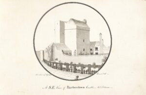
At Castlebrown, two portions survive on either side of Clongoweswood College, both well preserved though heavily overgrown. The northern section can be traced for roughly 550 metres; the bank runs three to four metres wide and still stands around 0.75 metres high, with a footpath worn along its top and ditches on both sides. In 1993, when a sewage pipeline was being laid through a modern breach in the boundary, an archaeological watching brief recorded its full profile: a total width of 8.5 metres, with a V-shaped western fosse over a metre deep, a flat-topped central bank rising 2.2 metres above the bottom of that fosse, and a broader, more rounded eastern fosse beyond. No finds were recovered, which is itself telling. This was functional infrastructure, not a monument, just earth moved against a perceived threat, and it has quietly outlasted the world that built it.