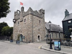
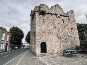
The southern edge of what was once a fortified borough survives not as stone ramparts but as a two-metre escarpment running along the slope, marked today by a dense hedge line that follows the rear of the burgage plots fronting onto Castle Street. Burgage plots were the long, narrow strips of land allocated to tenants in a medieval planned town, and their regular arrangement often left traces that outlast the buildings themselves. Behind Bay View House and Melrose, a possible associated bank, roughly three metres wide and two metres high, suggests there was once a more deliberate earthwork here, not merely a natural feature of the hillside.
The documentary record gives some sense of how seriously Dalkey's inhabitants took the upkeep of their defences. In 1482, the bailiff of Dalkey was granted the right to levy customs on all goods and merchandise entering the town, with the proceeds directed specifically towards murgage and pavage. Murgage was a tax raised for the building and repair of town walls, while pavage covered the maintenance of roads and paved surfaces, so the grant was essentially a licence to tax trade in order to keep the settlement functional and defended. Excavations carried out in 1996 at 59 Castle Street added physical detail to the documentary picture, when a ditch was uncovered directly beneath the partition wall between houses No. 7 and No. 8, interpreted as possibly marking the southern extent of one of those burgage plots. The work was recorded under licence 96E0297 and published by Murtagh in 1997.
The traces that survive are not immediately obvious to anyone walking through the village today, which is part of what makes them worth looking for. The southern line of defence is broadly contained between Cunningham Road to the south and Dalkey Avenue to the west, while a long linear boundary running south from Barnhill Road to the corner of Green Banks House is thought to represent the western limit of the medieval town. The eastern boundary is generally placed at the far end of Castle Street. The northern limit remains unidentified. None of this announces itself with signage, so the experience is more one of reading the terrain, noticing where a hedge sits too deliberately on a slope, or where a garden wall follows a line that predates the houses beside it by several centuries.