
Clare Castle, Clare, Co. Westmeath
Co. Westmeath |
Tower Houses
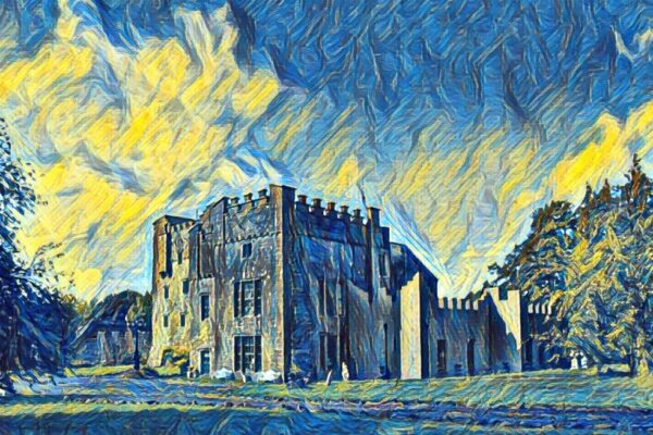
On the northeast edge of a steep hillock in County Westmeath stands Clare Castle, also known as Mullaghcloe, a tower house whose ruins offer extensive views across the surrounding pasture.
This rectangular structure, measuring roughly 12.4 metres by 8 metres with walls 1.8 metres thick, partially projects from the eastern side of a hilltop bawn that spans 40 by 50 metres. Though much reduced from its original grandeur, the castle's surviving features include a basement loop at the west end, an entrance in the western wall, and remnants of mural stairs in the northwest angle that once provided access to upper floors now lost to time. The interior remains filled with collapsed rubble up to what would have been the first floor level.
The castle's history is marked by violence and military significance. In 1544, the Annals recorded a grim event when Rory O'Melaghlin met his death here at the hands of Richard Dalton and his kinsmen during a night assault. The 17th century Down Survey map depicts the castle standing on church lands belonging to the Bishop of Meath, alongside several other fortifications in the parish including those at Dooneild, Rathskeagh, Killinbrack, and Ballikenny. During the Williamite War in Ireland, Clare Castle gained strategic importance when it served as headquarters for Generals de Ginckle and Douglas whilst they prepared for the Siege of Ballymore in 1691.
Today, visitors to the site will find a monument that speaks to centuries of Irish history, though time has not been kind to its preservation. The remaining stone walls, some standing 2 to 3 metres high whilst others are reduced to mere footings at the northeast and eastern sections, contain no visible dressed stones. The adjoining bawn to the west, now marked by a stony bank, once formed part of the castle's defensive perimeter. Archaeological surveys conducted by the ASI have documented the site's layout, ensuring that even as the physical structure continues to deteriorate, its footprint and significance remain recorded for future generations.
Tags
- Clare
Ref: WM01862
04-Essential
Nearby Places
Visitor Notes
Added by

Pete F
NLI, MS 723-4 – National Library of Ireland, The parish maps of the Down Survey for the County of Westmeath, attested by W. Petty, in 1659. Copied by Daniel O’Brien. A set of 67 maps with accompanying terriers in two volumes, 1786-7. Dublin.
Woods, J. (ed.) 1907 Annals of Westmeath ancient and modern. Dublin. Sealy, Bryers & Walker.
O’Donovan, J. (ed. and trans.) 1856 Annals of the kingdom of Ireland, by the four masters, from the earliest period to the year 1616. Dublin. Hodges, Smith and Co.
Salter, M. 2004 The castles of Leinster. Worcestershire. Folly Publications.