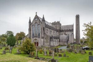
What makes it worth pausing over is not what is visible but what is implied by the shape of the ground beneath and around it. The site occupies the footprint of an early medieval ecclesiastical enclosure, the kind that would typically have been bounded by a large circular ditch and bank defining sacred space from the secular world outside. Most of that original geometry has long since dissolved into the urban fabric, but the curving line of the graveyard's northern boundary wall may preserve the arc of that inner enclosure, a ghost of early Christian planning still legible in the masonry.
The church here was known as Domhnach Mór, a placename derived from the Latin Dominicum, meaning simply a church, and recognised as a borrowing that dates to the 5th or 6th century. The site appears in the writings of Tírechán around 680, where it is called the Martartech, an Old Irish term meaning house-of-relics, suggesting it held some devotional significance well before the more famous ecclesiastical foundations of Kilkenny took shape. The reference recurs in the Vita Tripartitia, a Life of Patrick composed between 895 and 901, and again in a 12th-century Life of Canice. By that later period, however, the site had already lost much of its standing. The rise of St Canice's church during the 8th and 9th centuries drew attention and resources away from St Patrick's, and the diocesan reforms of the 12th century brought the lands under the see of Ossory. When the Hightown of Kilkenny was laid out in the late 12th century, St Patrick's found itself outside the new town boundary, absorbed into an extra-mural suburb called the borough of Donaghmore.
The physical evidence for all of this earlier history is thin on the ground. Nothing within or immediately beside the graveyard can be dated with confidence to before the Norman period. However, test-excavations carried out in 2005 by Cóilín Ó Drisceoil on Father Hayden Road, just five metres south of the graveyard's southern wall, uncovered a large curving ditch running northeast to southwest, under four metres wide and containing animal bone. This ditch may mark part of the southern circuit of the original enclosure, its curve corresponding to what the northern wall already hints at. Together, these fragments suggest that the familiar graveyard outline is not simply the product of later planning but a reduced trace of something considerably older.