Bridge, Dublin South City, Co. Dublin
Co. Dublin |
Bridges & Crossings
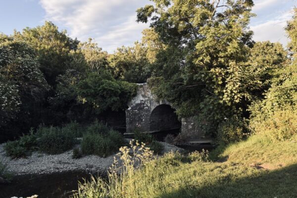
There is something quietly compelling about a river crossing that has existed long enough to appear on a seventeenth-century map, and the bridge spanning the Camac river in Dublin's south city carries that kind of unassuming longevity.
The current structure may look unremarkable at a glance, but the ground beneath it has been a crossing point for far longer than the present masonry suggests.
The evidence for the bridge's age comes from the Down Survey, a remarkable cartographic project carried out between 1655 and 1656 under the direction of William Petty. Commissioned to facilitate the redistribution of Irish land following the Cromwellian conquest, the Down Survey produced some of the most detailed maps of Ireland made up to that point, recording townlands, roads, waterways, and, crucially, bridges. The fact that a crossing at this location appears on those maps tells us the site was already considered significant enough to document in the mid-seventeenth century, and it is reasonable to assume the practical need for a crossing here predates even that. The Camac itself is one of Dublin's lesser-celebrated rivers, rising in the Dublin Mountains and flowing through Kildare before entering the Liffey near Kilmainham, and its course through the south city made it both a boundary marker and a working watercourse throughout the medieval and early modern periods.
The bridge is not a destination in the conventional sense, but for anyone tracing the older grain of the city, it rewards a closer look. The Camac in this stretch passes through a part of Dublin that still holds traces of its industrial and suburban past, and the river itself is easy to miss if you are not looking for it. Ordnance Survey maps, both historical and current, are useful for locating the exact spot. Those with an interest in Petty's Down Survey can cross-reference the original maps, which are held by Trinity College Dublin and also available through digitisation projects online, to see the crossing marked in its earliest recorded form.
Visitor Notes
Added by